New York Invasive Species Research Institute
Core Concepts
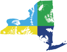
PRISM block: 5x5km cells across NYS that contain data on invasive species presence and management recommendations for the given species present. Each block is color coded by its management recommendation.
Objectives: Structured decision-making workshops with the NYS DEC, PRISM leaders, and other stakeholders resulted in the following decision objective for this tool: “How can managers allocate resources across invasive species, areas, and actions to reduce environmental, human health and safety, economic, and social impacts of invasive species at the highest treatment effectiveness?” This objective can be further defined as minimizing negative impacts to the environment (native species, ecological communities, and ecosystem processes), industry (agriculture and forestry), recreation, and human health and safety, while maintaining a maximum cost-effectiveness. These objectives guide the spatial layers used in the model and the weighted value of each PRISM block, which informs the resulting management alternatives.
Block values: For each 5x5km PRISM block, PRISM leaders weighed how valuable the block is for each of the following objectives: native species, watershed services, community structure agriculture, forestry, and human health and safety. These block values help inform the management recommendations for the species in that block. You can view the values assigned to each block in “PRISM Block Record”. The unweighted block values represent the raw values for that block from the original data source. The PRISM weighted block values are the values scaled to each PRISM, so that the values of each block within the PRISM varies between 0 and 1 for each objective.
Management alternatives:
- Search, Destroy, Prevent: There is no observed occurrence of the given species in the given block, but there is some probability of that species spreading to that block in the future. Actions may include: searching for the species in that block, treating the species if found, and/or preventing the spread of that species to that block.
- Direct intervention: There is at least one observed occurrence of the given species in the given block, and intervention actions are recommended for its control to mitigate negative impacts. Actions may include: invasive species control, suppression, and/or preventing the spread of the species to neighboring blocks. (This model does not consider multi-species prevention measures or biocontrol)
- No direct intervention: There is at least one observed occurrence of the given species in the given block, however no action is recommended; do not expend management resources on that species in the given block.
Budget: the example budget for this model assumes $500,000 for management over 5 years. Alternate budget levels may be included in later versions of this model.
How It’s Made
The PRISM Blocks map layer splits New York into a grid of 5×5 km blocks. Each of these blocks contains many data layers, including:
- Spatial layers related to the objectives (watershed processes, ecological communities, agriculture, forestry, human health, recreation, and native species presence data)
- DEC invasive species assessment data (invasion characteristics and severity of impacts)
- Invasive species presence data from iMapInvasives
- Expert rankings on the level of effectiveness of three different management strategies to control each invasive species: Search, Destroy, Prevent; Direct intervention; No direct intervention.
- Expert rankings of each management alternative’s effectiveness at varying species abundances and tiers
- Generalized management cost estimates by species
- Invasive species tier data from each PRISM
- Impacts of each invasive species on each management objective derived from the NY DEC Invasive Species Assessments
- Invasive species spread models developed with experts to describe 1) the probability of an infestation in one block spreading to other blocks, and 2) the probability of infestations in a block increasing in abundance
- PRISM leader’s value of objectives on different land blocks
This data was used to first estimate how management under a given budget will alleviate a given invasive species’s impact on the chosen objectives. This created a unique impact-budget curve for each species.
Then, for a given block with multiple invasive species, the tool used that impact-budget curve to find the budget that alleviates the greatest amount of impact for each of the species present, starting with the species for which your money can go the farthest. For example, the species that had effective direct management options to meet your objectives at a low cost might have been tagged to recommend the “direct action” management alternative. However, a species for which direct management was ineffective, or too costly to be effective, might have been tagged to recommend the “no direct action” management alternative.*
The result is a map of your selected region, with recommended management actions for each of the invasive species present in the blocks of that region, relative to the default budget level of $500,000 over 5 years.
*Keep in mind that there are other ways of arriving at these management alternatives.
Resources
View tutorial (arcGIS storymaps) for guidance on using the tool and generating reports.
Watch this presentation by Jen Price-Tack for more information on the tool’s development
How can we improve this tool?
- Email nyisri@cornell.edu with questions or feedback on the model.
- Email imapinvasives@dec.ny.gov with questions about the tool and map interface.